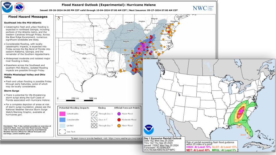
For years, the Excessive Rainfall Outlook (ERO) produced by the Weather Prediction Center (WPC) has served as the national “go to” product for describing where and when flood impacts may occur across the contiguous United States. This product is often referenced to in news media ahead of storms, and is frequently used by emergency managers in planning for weather related impacts. The methodology and science behind the ERO is sound and it tends to verify well. In fact, WPC’s statistics indicate that nearly 40% of flood deaths occur in areas highlighted with the High category.
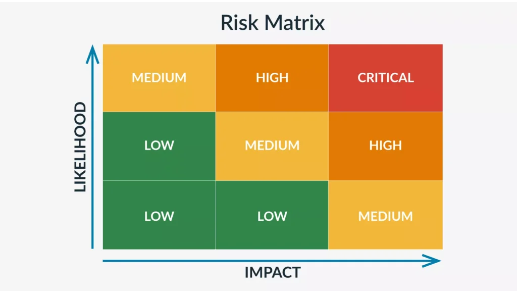
There can be some argument here about causation and correlation because we must remember that the ERO actually describes the likelihood of rainfall exceeding flash flood guidance. That is not to diminish the value of this product one iota, because in the theory of risk management, likelihood of the risk is every bit as important as the magnitude of the impact. The categories of the ERO and their likelihood of being exceeded are listed below:
| Marginal | ≥ 5% |
| Slight | ≥ 15% |
| Moderate | ≥ 40% |
| High | ≥ 70% |

So if the ERO describes the Y-Axis on the Risk Management Matrix, what does the National Weather Service provide to describe the magnitude of the flood risk?
You may be unaware of the National Water Center (NWC) – NOAA’s newest national center falling under the Office of Water Prediction. The NWC is responsible for predicting the full-spectrum of hydrological impacts from drought to floods. One of the first operational products from the NWC is the Flood Hazard Outlook. It is similar to the ERO, but instead of likelihood, it describes regions where flood impacts may occur and the magnitude of the impacts.
The FHO is issued twice a day at 12Z and 21Z. Similar to the ERO, it highlights area of concern and symbolizes those areas by magnitude and timing of impact.

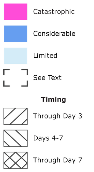
The magnitude of impacts (Limited, Considerable, and Catastrophic) are defined as:
- See Text: Ongoing recession limb flooding or flash flooding that is unlikely to merit Limited classification.
- Limited: Base flash flooding and/or minor river flooding
- Base to isolated considerable Impact-Based Warning (IBW) tags. Generally, minimal or no widespread property damage, but some public threat. Isolated water rescues may occur, but are limited evacuations of cutoff areas.
- Minor to isolated moderate river flooding.
- Considerable: Significant flash flooding and/or moderate/major river flooding
- Flash flooding with numerous considerable IBW tags possible. Widespread inundation of roads and structures, evacuations of people and/or transfer of property to higher elevations. Numerous swift/high water rescues may be possible.
- Widespread moderate to scattered major river flooding is possible. Moderate flooding is defined as some inundation of structures and roads near streams, evacuations of people and/or transfer of property to higher elevations.
- Messaging of widespread, life threatening flooding may occur and that urgent actions may be needed to prepare for flooding.
- Catastrophic: Exceedingly rare and widespread flash flood and/or river flooding
- Flash flooding with considerable IBW tags likely, with multiple catastrophic tags possible. Impacts include extensive inundation and/or destruction of roads, structures, significant evacuations of people and/or transfer of property to higher elevations. Water rescues of a significant number of persons are likely and overwhelming area and regional resources is possible (e.g. rooftop rescues).
- Widespread major river flooding, with “floods of record” possible. Major river flooding is defined as extensive inundation of structures and roads, significant evacuations of people and/or transfer of property to higher elevations.
- Messaging includes high end, life threatening flooding with significant disruptions to daily life likely.
The FHO is available as a static image and web mapping layer.
It may be enticing to try and correlate the ERO Categories (Marginal, Slight, Moderate, and High) to the FHO Categories (See Text, Limited, Considerable, and Catastrophic) but they can and frequently do diverge in operational use.
We can make a mental model why the products would diverge. Let’s assume that antecedent conditions have been soggy and wet. Stream flow is high and soils are nearly saturated and a new system is bearing down on your region. The rainfall rates associated with this system are actually pretty meager – but the system is nearly stalled in its forward movement. What this system lacks in intensity in makes up for with residence time. WPC may very well highlight your region with a slight – the antecedent conditions do make flash flooding possible with lower thresholds. NWC however, may highlight your region with a considerable polygon in the FHO due to the total volume of water from this system and potential for moderate to major flooding impacting roads, structures, and agriculture.
Similarly, it is important to realize that rainfall alone is not the only flood genesis mechanism – snowmelt and ice jams also produce significant high impact floods and those would not be included on an ERO. Conversely, EROs will highlight regions where flash flood guidance may be exceeded by forecast rainfall intensity, but the impacts are insufficient to be highlighted in the FHO.
Other differences to be aware of between the two products is the temporal range. The ERO discusses conditions on a single 24 hour period (12Z to 12Z), whereas the FHO describes flooding impact potential over the next 7 days which is symbolized by hatching within the polygons to show the hazard exists on Days 1-3, Days 4-7, or Days 1-7.
So, by using both products you can understand the flood risk in your area in a more holistic fashion. The ERO describing how likely something is going to happen, the FHO describing what will happen if it does. The National Water Center also provides live Flood Inundation Modeling (FIM) for approximately 30% of the nation including not only major rivers, but the small headwater streams, and even the creek that flows behind your house. We will detail how to access that data in a future blog post.

No responses yet